Our Three Regions

165 Miles. Five Counties. Three Regions.
Anthracite Region
The D&L’s most northern section runs from Wilkes-Barre to Lehigh Gap, encompassing Luzerne and Carbon Counties. The region is named after the hard ‘stone’ coal mined here, that would have traveled the corridor into cities and towns to be processed and used to fuel America’s 19th Century Industrial Revolution. Today, it’s the most forested region and the first to have a county with a complete and continuous section of the D&L Trail.
● D&L Trail: Anthracite Region Map & Guide
Lehigh Valley Region
The Lehigh Valley Region runs from Lehigh Gap to Easton, including Lehigh and Northampton Counties. This region is also home to the D&L offices, the National Canal Museum, and one of America’s only mule-drawn canal boats. The region, made up of Lehigh and Northampton Counties, is the most diverse in both its landscapes and communities, providing ample opportunity for outdoor recreation and vibrant cityscapes like that of Allentown, Bethlehem, and Easton.
● D&L Trail: Lehigh Valley Region Map & Guide
Delaware Canal Region
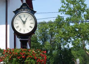
The Delaware Canal Region runs from Easton to Bristol, through Bucks County, filled with hundreds of historic landmarks. This section of trail runs on the former towpath, parallel to the Delaware Canal and Delaware River. Trail users can enjoy covered bridges and fieldstone houses as they ride, walk, and explore through New Hope, Washington Crossing, and the Delaware Canal State Park on well-kept red crushed stone path.

