The D&L Blog

As you read this, a GIS specialist from the National Park Service’s Cultural Resources Geographic Information System Facility is walking the towpath of the Lehigh Canal-GPS receiver in hand-gathering spatial data on all extant historical canal infrastructure.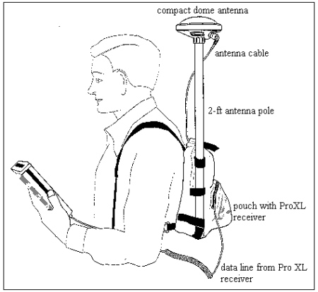
In 1982, a company named Environmental Systems Research Institute (ESRI) launched ArcInfo, a personal computer software product primarily used to manage land use and demographic data. The program had a visual representation component of polygons, lines, and points that was linked to a database management tool. Many consider ArcInfo to be the first commercial Geographic Information System (GIS), defined by the National Science Foundation, as “a computer-based system for capture, storage, retrieval, analysis and display of spatial (locationally defined) data.”
Since that first GIS over 25 years ago, the technology and its applications have drastically evolved so that few industries-from planning and government to marketing and public health-can now function without it. The improved accuracy of hand-held Global Positioning System (GPS) receivers has also made the acquisition of customized field data much easier. Users can gather the coordinates of any real-world feature and express it in relation to other geographic layers and sets of data.
Recently, the use of GIS has even extended into historical studies. Preservationists use GIS to create maps of historic districts and protected buildings. Archaeologists express their sites in GIS. Urban historians use it to express demographic change, the city building process, and immigration. A new book on the environmental history of Manhattan (Mannahatta by Eric Sanderson) even uses GIS to make predications about the pre-European ecology of the island.
Beginning in 1989, the National Park Service also incorporated GIS into their documentation and conservation projects, especially through the work of the Cultural Resource Geographic Information System Facility (CRGIS). The CRGIS promotes the use of GIS in historic preservation and, to that end, participates in and manages a number of projects each year. The projects range from landscape and cemetery inventories to battlefield and building documentation. The systems created by CRGIS have a number of applications from simple site management to historical interpretation of change over time.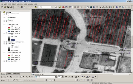
This summer, the D&L was fortunate to secure a contract with CRGIS to conduct a GIS inventory of historic Lehigh Canal infrastructure. Specialists will work in the field for a total of two weeks, collecting GPS coordinates for historic remnants. Back in the office, they’ll use the field data to create map layers that can be combined with other layers (historic districts, congressional districts, municipalities, park land, etc.) that will help the D&L manage the remaining canal resources and plan for their protection. A final phase of the contract will include GIS training for D&L staff and the provision of GIS-capable hardware so that we can take full advantage of the completed database and mapping. The use of GIS will also streamline some of our other planning, mapping, and trail development activities.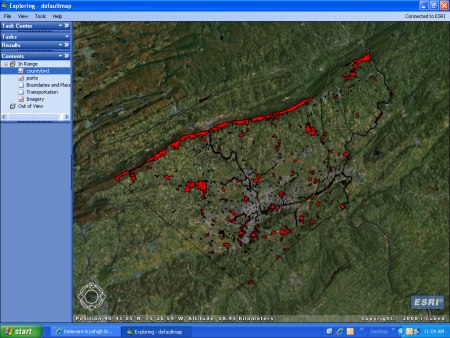
One specialist braved the week’s rain to get several days of GPS inventory recorded. Expect to see others in the field later this summer and probably through the fall. Check back for updates about what they find!


