2026 Development and Project Management of D&L Trail Interactive Map RFP

- Home /
- 2026 Development and Project Management of D&L Trail Interactive Map RFP

Request for Proposals: D&L Trail Project Management and Developer Services
The submission window for this proposal has closed.
Delaware & Lehigh National Heritage Corridor, Inc. (DLNHC) is soliciting proposals for the development and management of a new D&L Trail Interactive Map in accordance with the below Request for Proposal (RFP). Interested consultants should review the RFP document for more information and instructions for submitting qualifications for consideration.
To allow additional time for thoughtful and competitive submissions, the deadline for the D&L Trail Interactive Map RFP has been extended to May 26, 2026 at 4 PM. We encourage interested applicants to take advantage of this extension to refine and strengthen their proposals.
Click Here to View the Request for Proposals
Timeline
| Issue Notice for Request for Proposals | April 27, 2026 |
| Cutoff for Written Questions | May 8, 2026, 4:00 P.M. |
| Proposals Due | May 26, 2026, 4:00 P.M. |
| Proposals Reviewed | May 27 to June 5, 2026 |
| Interviews | June 8 to June 19, 2026 |
| Selection & Notification | Week of June 22, 2026 |
| Project begins | June 29, 2026 |
D&L Trail Interactive Map RFP Questions
Please enter your question for the Development and Project Management of D&L Trail Interactive Map RFP. Enter each question individually.
Submitted Questions and Answers for the RFP
Written questions and answers will be posted to this webpage as they come in by May 15, 2026 at 4:00PM.
- What mapping platform or technology stack powers the current D&L Trail interactive map (e.g., Leaflet, Mapbox, ArcGIS, Google Maps API, or custom-built)? Understanding the existing foundation is essential for accurately scoping a rebuild versus migration approach.
- We currently use Google Maps, for our interactive map on the website and ArcGIS for all other mapping needs.
- The RFP references coordination with a “website consultant” for integration. Is a separate website development firm currently under contract or planned for concurrent engagement? If so, what is the expected handoff point between the map consultant and the website consultant, and which party owns integration responsibility?
- DLNHC currently uses consultant and web development firm. They built the current website and manage any infrastructure updates along with design changes. The map consultant will build a map that can be integrated into the website, but the responsibility for embedding the map is on our current website consultant.
- Does DLNHC have a preference or requirement for the mapping platform to be used in this engagement (e.g., ArcGIS Online, Mapbox GL JS, Felt, Google Maps Platform, or open-source Leaflet/OpenLayers)? Platform choice has significant licensing cost implications within the stated $50,000 budget.
- DLNHC currently uses ArcGIS Online to house internal data like mapping points, restrooms, parking lot size, EMS access points, participating Trail Friendly Business locations, etc. DLNHC holds a slight preference for ArcGIS since we already use the platform. However, the Consultant should select the platform that best suits DLNHC’s needs within the budget.
- The RFP states the new map must be compatible with “embedding in a website and use on a mobile app.” Does DLNHC have an existing mobile app, and if so, what platform is it built on (iOS native, Android native, React Native, PWA, or other)? Or does “mobile app” refer to a mobile-responsive web embed?
- DLNHC currently has an app “DandL Discover” available on both iOS and Andriod OS. The app is currently outdated and in need of future infrastructure changes to the functionality. One of the goals for the interactive map is to be compatible with a future newly built app. The current app is built with STQRY.
- The RFP references a compiled dataset (“Web Map Updates RFP”) including the current Interactive Map, Guidebook, and Regional Brochure Maps. Can this data package be made available to proposers prior to the May 22 submission deadline? Reviewing it is important for accurately estimating data collection and verification effort.
- The D&L Trail Guidebook and trail brochures are available on DLNHC’s website. The “Web Map Updates RFP,” linked on page 4 of the RFP, compiles all the data from the guidebook, trail brochures, current interactive map, and internal ArcGIS online data.
- Regarding data accuracy verification: is DLNHC expecting a desktop/GIS audit of existing data, or are in-person trail visits required to verify field conditions (e.g., trailhead amenities, mile markers, ADA accommodations)? This distinction significantly impacts project cost and timeline.
- DLNHC has already identified which metrics are out of date or missing within our current data set. The Consultant will work with the Trails & Conservation Coordinator to survey landowners, and if needed, conduct field visits to ground truth.
- Where does Trail Friendly Business (TFB) data currently reside — a database, spreadsheet, or third-party directory, and is there an existing API or export mechanism available for integration into the new map?
- The TFB data is housed on ArcGIS online, DLNHC website, and excel spreadsheet. All relevant data will be shared with the selected consultant.
- The trip planning feature is described as surfacing “nearby events.” Where does DLNHC’s events data currently live, and is there an existing calendar system or CMS that should feed into the map? Or is the consultant expected to build or recommend a new events data structure?
- DLNHC has a calendar plug-in that currently only tracks our hosted events. Events that DLNHC participate in are not posted on our website calendar but instead tracked internally. We would like there to be a way for community partners to submit their events along the trail (under 2 miles, pedestrian/cyclist friendly) and for the events to be displayed alongside the relevant trailhead/trail section.
- Approximately how many Trail Friendly Business listings and trail points of interest (POIs) are currently in the system? This is needed to accurately estimate data migration effort and map render performance requirements.
- We currently have over 90 businesses enrolled in our program with plans to continue growing the partnership. We have more than 30 nearby greenspaces, over 20 public transportation stops, over 30 trailheads and trail access points. We estimate 250 – 400+ potential POIs.
- The trip planning feature references the ability to “plug in a start and end destination.” Is this intended as a trail segment selector that surfaces relevant amenities, closures, and TFBs along that segment — or is turn-by-turn navigation expected? These represent significantly different levels of technical complexity.
- We envision this interactive map to serve as a trip planning resource to be used prior to hitting the trail, rather than for turn-by-turn wayfinding.
- Regarding the trail closure auto-expiration feature: who will be responsible for entering closures and setting expiration dates? Is there an existing data source for closure information (e.g., state agency feeds) or will this be fully manual data entry by DLNHC staff?
- This interactive map needs to easily editable by DLNHC’s staff including displaying trail closures. DLNHC manually adds this information, some closures are longstanding and will not require setting auto-expiration, and others are short-term with a set re-open date. DLNHC will also need the interactive map to differentiate between trail closures and trail gaps (where D&L Trail does not yet exist).
- The RFP states the map “should include the potential ability to show detours.” Is detour display an active deliverable within this engagement’s scope and budget, or is this an architectural requirement (build the framework now, implement detours in a future phase)?
- The architecture should be built with the ability for DLHC to create detours that can be displayed.
- Regarding multi-language support: does DLNHC have a priority list of languages to support (e.g., Spanish, Mandarin, Portuguese)? Additionally, is DLNHC expecting the consultant to provide translated content, or to implement a translation framework (such as a Google Translate API overlay) that DLNHC or its partners can manage?
- DLNHC does not expect the consultant to translate any of our material, instead we want the map to work seamlessly with a translation framework. We do not have a list of priority languages, but the most spoken language in DLNHC’s service area, behind English, is Spanish by a large margin.
- For ongoing content management of closures, TFBs, events, mile markers, and POI updates after launch — is DLNHC expecting a custom-built admin interface, or is integration with an off-the-shelf platform admin (such as ArcGIS Online, Felt, or a headless CMS) an acceptable approach?
- Off-the-shelf admin interfaces are acceptable.
- Is the $50,000 project budget inclusive of travel expenses? The RFP requires the ability to travel the D&L Trail and attend at least three in-person focus group meetings and four steering committee sessions. Clarification on whether travel is budgeted separately or within the cap is important for proposal accuracy.
- Travel expenses should be included in the $50,000 budget.
- Is payment structured around milestone deliverables, monthly invoices, or a combination? The sample agreement references Work Orders — will each project phase be issued as a separate Work Order?
- We expect to arrange the payment schedule with the winning bidder but prefer partial payments made at regular intervals throughout the project period.
- What is the decision-making authority of the Steering Committee relative to project scope? Can the Steering Committee direct changes to deliverables mid-project, and if so, is there a Change Order mechanism to address scope and budget impacts?
- The Steering Committee will only serve in an advisory capacity, decision making authority lies with the D&L team, including the Trails & Conservation Coordinator and Executive Director.
- Who holds final approval authority over the map design and data — the Trails & Conservation Coordinator, the Steering Committee, or the Executive Director?
- The Trails & Conservation Coordinator.
- What does the training and resource document deliverable entail specifically? Is DLNHC expecting a written guide, recorded video walkthrough, live training session(s), or a combination?
- DLNHC expects that a training guide/document and/or video walk-through is produced entailing how to update and edit the map with opportunities for a live demo and Q&A with staff.
- What is the current process you use for updating data, especially in the context of updating trail closure statuses, and what processes are you are hoping are improved with this new map?
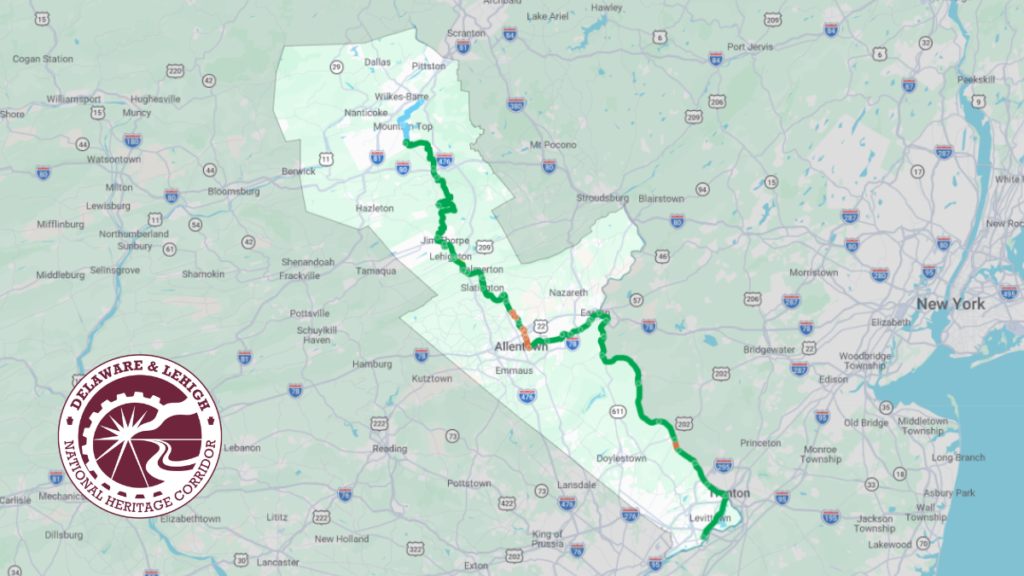
- All trail closures are currently manually added and removed. DLNHC would like the option for closures with set end dates to automatically be removed. On DLNHC’s current platform, entire trail sections are colored orange to show that there is a closure within the section, we need the new map to show a closure at the impacted mile markers to reduce confusion with our trail users.
- For data collection of information like overnight parking availability, ADA accommodations, bathrooms, and other trailhead amenities, would utilizing a subscription-based data source to acquire this data be acceptable?
- This is acceptable.
- What is the plan for ongoing maintenance of the map after it is developed and deployed
- DLNHC expects training materials that enable DLNHC staff to maintain and update the map.
- How will the map be hosted and served?
- Up to Consultants discretion.
- Under the Data Collection section, there is a sentence stating that “the accuracy of the data needs to be verified.” Is that specifically referring to the Web Map Updates RFP spreadsheet that is linked in the previous sentence, or does data verification need to be done for all 150+ miles of the D&L Trail?
- DLNHC is referring to the Web Map Updates RFP spreadsheet needing some updates. Metrics that need updating or new data collecting include, but not limited to, elevation change and available facilities.
- What components would you like to prioritize using AI? What is the vision for AI being leveraged?
- DLNHC is developing internal policy for use of AI by our team and we do envision a future where acceptable uses will be part of our daily operations. We are open to AI functionality in the map. We are also expecting all bidders to explicitly state if/how they will use AI to develop the map.
- For data collection and verification, what are the authoritative data sources? Is there a desire for fresh capture of data or is it acceptable to bring datasets together?
- DLNHC has already compiled all available date on the D&L Trail into one spreadsheet, Consultant will work with Trails & Conservation Coordinator to determine which data sets need updating.
- Which languages should be prioritized at launch? Is full content translation expected, or interface-only translation? Does DLNHC anticipate follow-on phases building on this work?
- The second most spoken language in DLNHC’s service area by a large margin is Spanish. DLNHC does not expect the consultant to translate any of our material into other languages, and nor do we currently anticipate any future phases to build upon the language feature.
- Can you provide more detail on the webpage/app this map will integrate with, including any server, data format, or tech stack requirements?
- DLNHC has intentions to redevelop our website in the future, but no current plans in the works. The map Consultant should create a map, and our current DLNHC website Consultant will be responsible for embedding the map into the website. If DLNHC redevelops our website in the future, the future Consultant responsible will create a website that can support the interactive map created during this project.
- Will the map be hosted on DLNHC servers, or is hosting infrastructure part of the project scope? If hosted by DLNHC, can you share details about the environment?
- The interactive map is not hosted on DLNHC servers. Instead, it leverages Google Maps as a third-party platform, which provides both the hosting infrastructure and mapping services. All core map functionality—including basemap rendering, geospatial data display, and user interaction—is delivered through Google Maps APIs and embedded within the DLNHC website. As such, hosting infrastructure for the map itself is not part of the project scope, beyond standard website hosting required to serve the webpage containing the embedded map
- For updates, what CMSs, software, or data formats has your team used previously that you consider easy to maintain?
- DLNHC currently and has only used WordPress for our CMS.