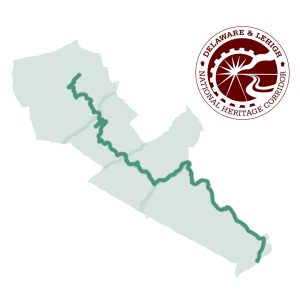
Take Action
- Home /
- Take Action

Take Action. Make a Difference.
The DLNHC Needs You!
HELP US PROTECT A VITAL CONNECTION TO NATURE, RECREATION AND HISTORY
If we all step up and take action, we can unleash the true potential of the Delaware & Lehigh National Heritage Corridor (DLNHC). Take Action is here to help you form a deeper connection to this vital public resource by helping to make it even better.
Welcome to Your Spot
Come Explore the D&L Trail
Find your perfect outdoor space to gather with friends and family, have fun, exercise, and enjoy nature!
0
Miles of Open Trail
0
Trailheads
0
Water Access Areas
It's Always Close By
The D&L Trail is closer than you think!
No matter where you live—in the city, the burbs, or the country—there’s always a D&L Trail trailhead nearby. Parking is free, simple, and easy, and most trailheads are ADA-accessible.
Come check out the D&L Trail and find your special spot.
D&L Trail Interactive Map
It's The Perfect Place To Meet Up
Celebrate your big moments at the D&L Trail—or just meet up with some friends!
D&L Trail trailheads offer spacious outdoor areas perfect for family gatherings, parties for all occasions, work events, social clubs, and team gatherings. And it’s always free of charge.
The D&L Trail is also a great place to meet up with a friend or two to sit and chat, take a walk, or enjoy a picnic.
DLNHC Calendar
It's Got Tons To Do
The D&L Trail is closer than you think! No matter what your idea of outdoor fun, this is the place to do it!
Toss the football or baseball, throw the frisbee, play some cornhole. Set up a table and play whatever board or card game you’re into.
Take to the water—go boating, fishing, tubing, or kayaking. Or just wade in a little if that’s more your speed. Come check out the D&L Trail and find your special spot.
Plan Your Trip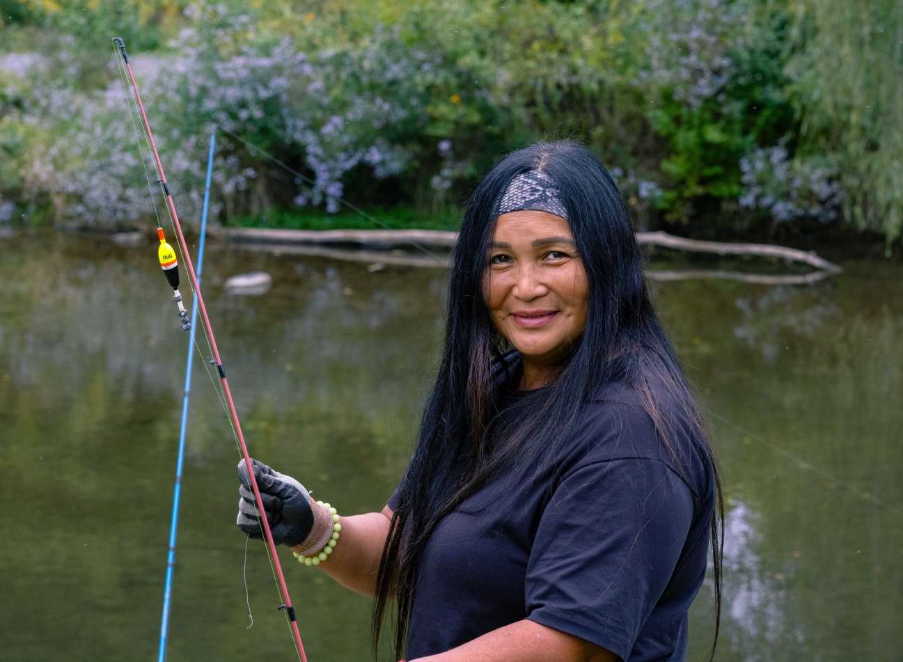
It's A Great Way To Get Moving
Whether you’re into fitness or just looking for a pleasant stroll, the D&L Trail is perfect for you!
All fitness levels and all ages enjoy the D&L Trail. And you don’t need fancy gear or a gym membership to get your sweat on here!
Walk. Run. Bike. Try some yoga or tai chi. Bring the little ones along—there’s room for everyone!
Signature Programs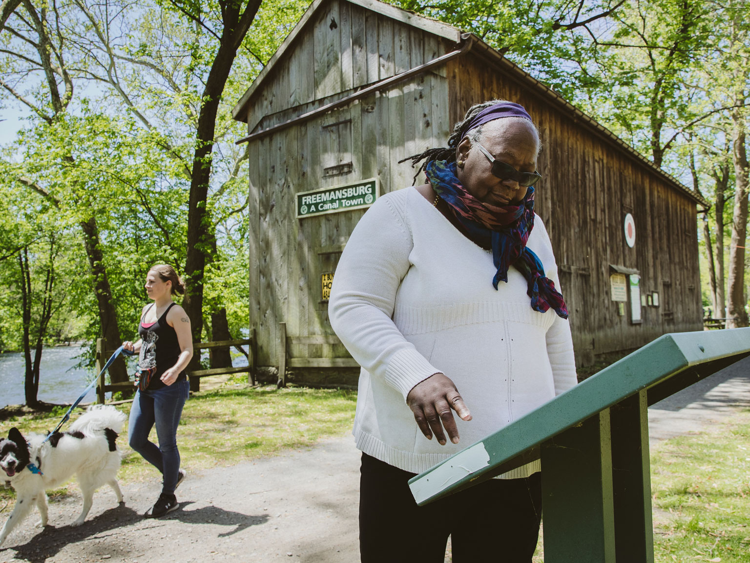
It's All About Unwinding
When life gets hectic, you can always unwind at the D&L Trail.
This is the place to get away from it all, with ample greenspace and a breath of fresh air every day of the year. And you don’t have to go far to enjoy it—the D&L Trail is always just a short drive away.
Relax and take it all in at the D&L Trail.
Health & Wellness
Share Your Story
Do you have a connection with the D&L Trail? Share your full story or your favorite #MyDLTrail moments to inspire our community!
Share Your StoryRiding From Mountain Top to Bristol in Two Days
Nicholas Broderick In October 2025, I took on an unforgettable challenge: riding the entire Delaware & Lehigh National Heritage Corridor (D&L) Trail – covering 147 miles in just over two days. Starting in the Pocono Mountains and finishing near Bristol’s suburbs, I split the trip with an overnight stay in Bethlehem, PA. The ride was a mix of smooth, scenic stretches and a few adventurous detours, but overall, it was an experience I’ll never forget.
The Walk and Talk Method: Strengthening Bonds on the D&L Trail
Rebecca Escott There’s something about walking and talking that strengthens relationships and builds connections. When someone says, “We should get together,” the default is often a bar or restaurant. Or maybe your kids are restless and you’re thinking, “Get out of the house!” but where? Walking and talking on the D&L Trail is the perfect answer to both situations.
How Far Are You Riding Today? Miles of Connection Await on the D&L Trail
Rob Ostry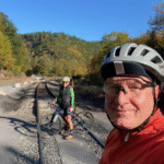 The more time I spend on the D&L Trail, the more connections I make. After years as a quiet Delaware & Lehigh National Heritage Corridor member, I attended my first Bike and Brews event in September 2024—and discovered the vibrant community behind the trail. Since then, I’ve gone from riding solo to sharing long rides with new friends and finding inspiration to volunteer and help make the Corridor even more vibrant.
Pedaling with Purpose
Marc Swanson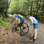 When I signed up for Trail Patrol training, I thought it would just be a way to give back to the D&L Trail I’ve loved for years. What I didn’t expect was how much purpose—and adventure—it would add to my rides. From meeting fellow cyclists to helping a stranded rider on National Trails Day, here’s what being a Trail Patroller means to me.
Trials & Tribulations on the D&L Trail
Liz Rosencrans When I set out on my fall ride along the D&L Trail, I expected crisp air and colorful leaves—but what I got was a mix of beauty, challenges, and lessons learned. From unexpected detours to moments of pure autumn magic, here’s how my two-day journey unfolded.
Pedals & Plumage: My Sobriety Journey on the D&L Trail
By Evan Fisher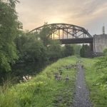 In spring 2020 I quit drinking and found the D&L Trail, trading anxiety for morning bike rides and birdwatching. After pre-dawn rides spotting kingfishers, chickadees, flickers, and eagles, I emerged healthier, more mindful, and deeply connected to the trail.
Embracing the D&L Corridor's History, Beauty, and Community
By Brittany Brown I'm captivated by the D&L Corridor's mix of industrial history and natural beauty—having completed the Bucks County Trail Challenge in just two days and savored lazy, canal-side picnics with my husband after grabbing treats at Homestead General. I'm proud to back its Take Action Campaign and can't wait to share tips for exploring this local treasure.
Fun, Freedom & Home: My D&L Trail Story
By Brit Kondravy As part of the Delaware & Lehigh's Take Action Campaign, I'm sharing how the D&L Trail embodies fun, freedom, and adventure—and feels like a home away from home that reconnects me with nature, the river, and myself. What does the D&L Trail mean to you?
From Solo Rides to Leading the Pack on the D&L
By Jennifer Cunningham I went from anxious, solo D&L rides and pandemic-induced FOMO to nervously joining CAT's women's group—then, after dozens of rides, became a League-certified instructor, CAT vice-president, and co-leader of weekly outings. Riding together, securing grants for overnight trips, and hosting winter workshops, I found my joy in bringing people together through bike-powered adventures that change lives.
Protect Waterways
Water Quality
Love the Corridor? Join a watershed association. These groups preserve our natural resources by protecting streams, rivers and waterways.
0%
Of Streams in Lehigh Watershed Are Impaired
0
Watersheds in the Corridor (plus many sub-watersheds)
0+
Total Stream Miles in the Corridor
0
Miles of Canal in the Corridor
What is a Watershed?
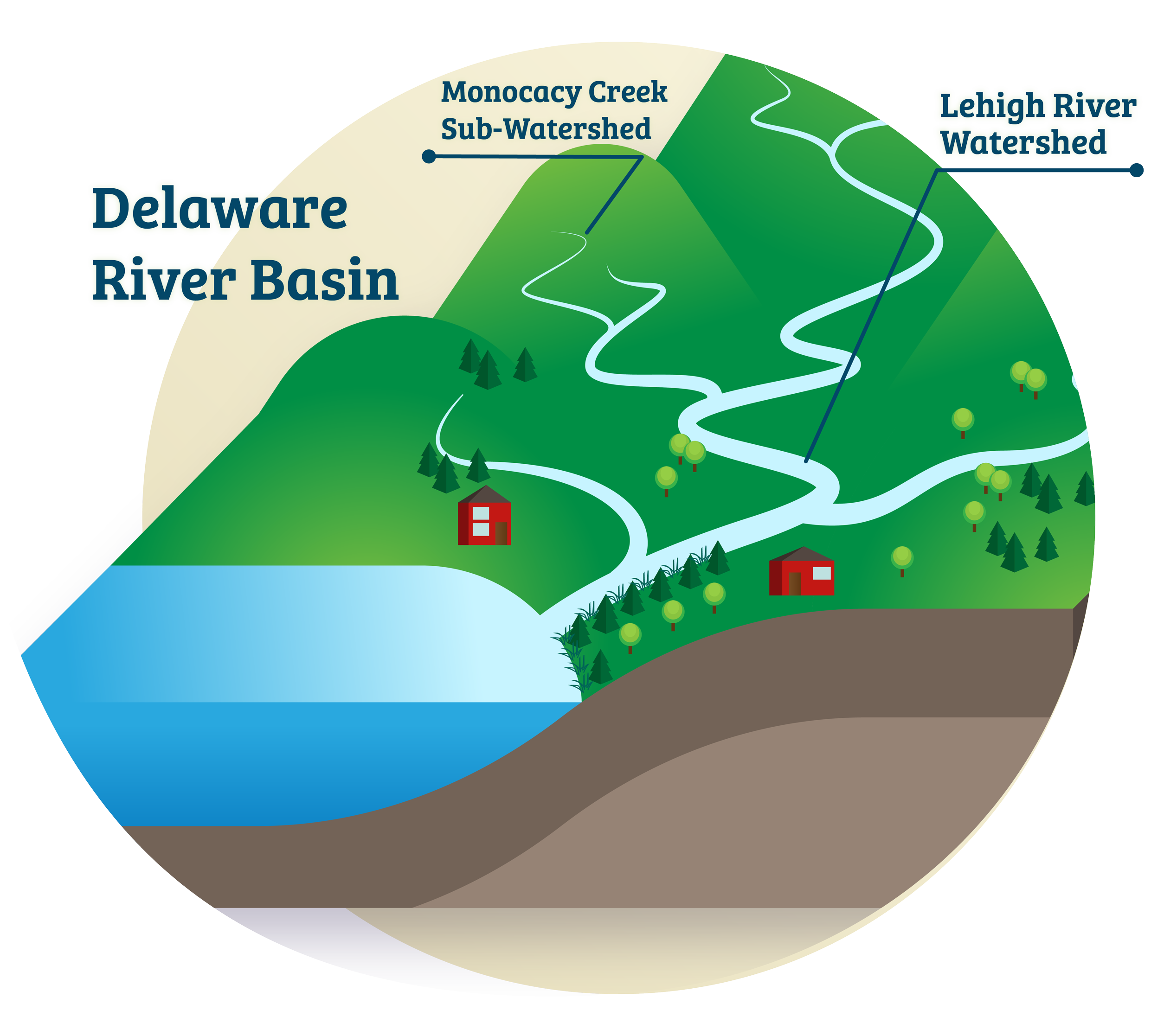
Watersheds are areas of land that channel rainfall and snow melt to rivers, streams and other bodies of water and they are a key element of a healthy ecosystem. The DLNHC is comprised of five counties – Luzerne, Carbon, Northampton, Lehigh, Bucks and part of several regional watersheds:
- Lehigh River Watershed
- Chesapeake Bay Watershed
- Upper Susquehanna-Lackawanna Watershed
- Schuykill River Watershed
- Delaware River Basin
Luzerne County is part of the Lehigh River Watershed and the Chesapeake Bay Watershed.
Most of Carbon County is in the Lehigh River Watershed. However, the northwestern tip of the county is in the Upper Susquehanna-Lackawanna Watershed and small sections along the border with Schuylkill County are in the Schuylkill River Watershed.
Most of both Lehigh and Northampton counties drain to the Lehigh River (79% of Lehigh and 47% of Northampton) which drains to the Delaware River, while the western parts of Lehigh County are in the Schuylkill River Watershed. The eastern portion of Northampton County drains directly to the Delaware River. Nearly all of Bucks County drains into the Delaware River. Along the northwestern edge of the Bucks County, the East Branch Perkiomen, and the Perkiomen Creek feed into the Schuylkill River.
Why You Should Be an Advocate for Water Quality?
A distinct relationship exists between land use and water quality. Knowledge of this relationship is necessary for both land use planning purposes and protection of water resources. Unless federal, state and local decision makers act to improve protections for local waterways, the area’s clean water and wildlife habitat could suffer irreversible harm. The public can demand federal and state government decision-makers make crucial funding and legislative decisions to protect water quality from land development throughout the watershed. We need your help to protect one of our most valuable natural resources.
LEHIGH RIVER WAS RECENTLY NAMED ONE OF AMERICA’S MOST ENDANGERED RIVERS.
The Lehigh River is the “backyard river” for half a million people and serves as the keystone to eastern Pennsylvania’s outdoor recreation industry. The Lehigh River Watershed covers approximately 1,345 square miles of land and 2,000 miles of waterways. Areas that surround rivers offer outdoor gathering spaces and accessible recreation opportunities for people throughout the watersheds.
Unfortunately, the region’s role as the eastern seaboard’s logistics hub puts the rivers’ health at risk, being one of America’s most endangered rivers. To date, there are over four square miles of warehouses and distribution centers throughout the Lehigh River Watershed.
WATER QUALITY THREATS & PROTECTANTS
Learn more about the threats to our waterways and strategies employed to improve and protect the water quality.
Threats
Lehigh Valley Planning Commission data shows that industrial development continues to grow within the Lehigh Valley, with industrial reviews steadily increasing from roughly 6 million square feet in 2015 to over 18 million in 2022. As the region has become a hub for the global e-commerce economy, warehouse development continues to make up a growing share of the industrial activity. The 4.2 million square feet of warehouse space approved in 2022 continues a five-year growth spurt in which approvals ranged from 3.5 million to 6 million square feet annually. In addition, new proposals in 2022, that are currently moving through regulatory review, added another 13.5 million square feet to the pipeline. Data LV Development (lvpc.org)
Land Development leads to increased flooding, pollution, and habitat-destroying sediment from stormwater runoff, not to mention more expensive drinking water. Development converts critical forests and wetlands to impervious hard surfaces – like roofs and parking lots – that don’t allow water to work its way into the soil and groundwater reservoirs. These issues are amplified by periods of drought and intense storms. Poorly managed and overwhelming volumes of stormwater flowing from developed areas increases the amount of soil and sediment in our creeks, streams and rivers, increasing the risk of flooding by filling storm drains and destroying habitats for important aquatic species like trout, as well as increasing the cost to treat drinking water.
Urban and industrial pollution, along with abandoned mine drainage, degrade fish habitat in the lower Lehigh River Watershed, impairing water quality and making the Delaware River unsafe for fish consumption due to contaminants like mercury. The major pollution sources for local streams are pathogens (bacteria, viruses and fungi), urban runoff and stormwater, and agriculture. Abandoned mine drainage from coalfields in Carbon and Luzerne counties also adversely impact the health of the Lehigh River. As a result of these pollutants, much of the Lehigh River is classified as impaired meaning it’s too polluted to safely support aquatic life and does not meet standards necessary for fish consumption.
Improve & Protect
A riparian buffer is an area of vegetation that is maintained along the shore of a water body to protect water quality and stabilize water channels and banks. The riparian buffer reduces the amount of runoff pollutants entering the stream by filtering the water before it reaches the stream. It also controls erosion, provides leaf-litter to the stream and habitat for many desirable species of amphibians, reptiles, mammals and birds. If wide enough, riparian buffers function as corridors for migrating large and small mammals. The riparian vegetation affects the stream channel shape and structure, as well as the stream’s canopy cover, shading, nutrient inputs and amount of large woody debris entering the stream. Riparian canopy cover (branches and tree crowns overhanging a stream) is important not only for its role in moderating stream temperatures through shading, but also as an indicator of conditions that control bank stability and as an energy source from leaves that will fall into the water. Aquatic macroinvertebrate organisms such as stoneflies eat, shred and break the leaves into coarse and fine particulate organic material that becomes food for other stream organisms.
Many municipalities take a reactive approach to proposed land development rather than planning and acting on behalf of broader-scale issues like climate resiliency, walkable communities and watershed management. By connecting local officials with reporting tools, applicable laws and citizen priorities, municipalities can plan for community growth while protecting valued resources.
- Comprehensive Plans that guide future development can and should be updated to protect local waterways – especially if they’re over 10 years old. These plans give communities a chance to outline where development should occur in order to improve safety, promote economic development, and protect natural spaces.
- Your town may have a Natural Resources Inventory, or NRI, that compiles crucial information on local geology, soils, streams, wetlands, forests, wildlife, and cultural assets. These inventories include maps and data sets that help your community visualize its resources and how they relate to the surrounding areas and existing developments. NRI’s provide a strong foundation for informed land-use planning and decision-making.
- The Municipalities Planning Code (MPC) enables local governments to enact local ordinances that regulate land use and prioritize natural resources. They can include Official Maps, Subdivision and Land Development Ordinances (SALDO), and Zoning Ordinances.
- Legislation such as the Clean Water Act help to reduce pollutants, helping to protect and restore impaired waters, ensure healthy waterways and safeguard human health and ecological resources. Public participation is crucial in passing this type of legislation.
Join a Local Watershed Association
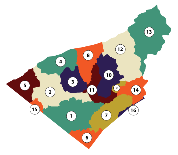
The Watershed Coalition of the Lehigh Valley is a non-profit association of the region’s watershed groups, working to keep the Lehigh Valley’s streams clean and healthy through education, promotion of conservation practices, and collaboration. Below is a list of sub-watersheds in the Lehigh Valley. Tap the links to learn more about existing watershed associations, or how to be involved if a location does not currently have a watershed association.
1. Little Lehigh
2. Jordan Creek
3. Coplay Creek
4. Trout-Bertsch Creek
5. Maiden Creek
6. Perkiomen Creek Headwaters
7. Saucon Creek
8. Hokendauqua Creek
9. Nancy Run
10. Monocacy Creek
11. Catasauqua Creek
12. Bushkill Creek
13. Martins/Jacoby Creek
14. Fry’s Run
15. Saucony Creek
16. Cooks Creek
Take the Next Step
Find Out Who to Contact to Become an Advocate
Who to Talk To
Find Your Legislator
Write a Letter
Funding/Support for Water Quality
Write a Letter
Water Quality Through Land Use
Feeling Inclined?
Attend a Public Meeting
Choose Your County
OTHER WAYS TO TAKE ACTION
Water Quality Education and Resources – Penn State Extension
Penn State Master Watershed Steward Program
Riparian Buffer Maintenance Opportunity: Stream Team: Volunteer Opportunity – Wildlands Conservancy
Lehigh River: Community Watershed Associations – Watershed Coalition of the Lehigh Valley
Delaware River: Delaware Riverkeeper Network
Susquehanna River: Middle Susquehanna Riverkeeper – About Us
Schuylkill River Watershed: About the Watershed – Schuylkill River Greenways
Chesapeake Bay Watershed: Alliance for the Chesapeake Bay | 50 Years of Conservation
Close Trail Gaps
D&L Trail Gaps
Where are our civically minded cyclists, walkers, hikers and wildlife enthusiasts? Volunteer, donate, attend a municipal meeting in support of improving D&L Trail gaps.
0+
Miles of D&L Trail When Complete
$0Million
Needed to Close Trail Gaps
0
Current LandOwners
0
Miles of Trail Gaps
What is a Trail Gap vs. Trail Closure?
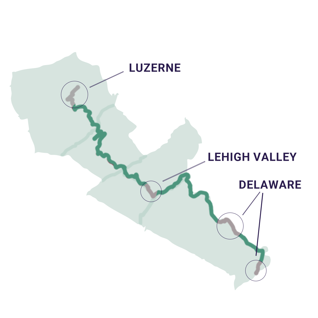
Trail gaps are areas where the trail doesn’t exist yet, while trail closures are temporarily closed sections of trail due to damage or maintenance. Trail closures typically reopen in a relatively short time (months to a few years), while Trail Gaps take much longer to officially open (years to decades). The D&L Trail has three major gaps preventing a connected route from Bristol to Wilkes-Barre known as the Luzerne Gap, the Lehigh Valley Gap, and the Delaware Canal Gap. Join us and our partners in creating safe, continuous trail connections in the Corridor.
WHY CARE?
Developing a connected D&L Trail at over 165 miles will create a the longest multiuse trail in PA, benefiting communities by boosting local economies, improving health, and enhancing access to nature. The D&L Trail gaps impact local transportation and community connectivity as well – closing these gaps will make Corridor communities more walkable and local resources more accessible.
Help us advocate for a connected D&L Trail
Everyone can experience the benefits of a long-distance multi-use trail.
Poor health rankings, high disability rates, and poverty in communities near trail gaps can be improved by connecting to the D&L Trail. Communities surrounding the Luzerne and Lehigh Valley Trail Gaps have some of the lowest health rankings and highest disability rates in the Corridor compared to state averages. High rates of poverty and low medium household incomes tacked on top of poor health rankings can lead to elevated health risks. Getting outside to exercise via resources like the D&L Trail have been proven to reduce the risk of physical and mental health issues and lower the risk of premature death.
Closing D&L Trail Gaps will improve local trail systems and promote connections to local resources for all. Just as health and economic disparities exist near the major D&L Trail Gaps, gaps in equitable access to surrounding resources are also present. The D&L Trail is an important part of the active transportation networks within the Corridor. It is a “spine” trail, or major trail that local trails and sidewalks connect to in order to link with community resources like employment centers, food stores and businesses. In Trail Gap areas equitable access to resources is often limitted for those that have to rely on walking or biking for travel. Closing these gaps will not only improve access to the trail itself for residents, but will improve the ability for many to use a safe and connected off road trail network for transportation.
Linking the D&L Trail through scenic areas provides safe access to unique ecosystems for all. The D&L Trail twists and turns with the Lehigh and Delaware rivers and the rolling hills of the Delaware, Lehigh and Wyoming valleys, connecting trail users to the unique ecosystems of the Corridor. In trail gap areas access to the surrounding rivers and forests are often limitted and can be daunting and difficult to reach for those that aren’t familiar with the wild environment. Linking the D&L Trail in these places will provide a safe and well marked access to natural resources for individuals of all mobility and experience levels.
Connecting the D&L Trail brings major economic benefits, boosting local economies and creating jobs. Long distance trails can have major positive economic impacts for surrounding communities. Many of the towns within the Lehigh Valley and Luzerne Gaps have low income levels and high rates of poverty compared to the state averages. But the outdoor recreation economy is no joke and its rapidly growing- Governor Shapiro recently cited that “outdoor recreation adds $14 billion to our (state) economy and supports 150,000 state jobs and local jobs” as of 2021. According to the PA Department of Conservation and Natural Resources, the outdoor recreation industry added more to the value of all goods and services produced in PA in 2021 than all of the state’s farms, oil and gas wells, and lawyers! With trail use across the nation increasing at a record rate, these economic benefits will continue to grow– but the towns within the D&L Trail gaps can’t experience these benefits until the Trail is connected.
Be An Advocate
Take the Next Step
Find Out Who to Contact to Become an Advocate
Who to Talk To
Find Your Legislator
Write a Letter
Luzerne Trail Gap
Write a Letter
Lehigh Valley Trail Gap
Feeling Inclined?
Attend a Public Meeting
Choose Your County
THE LINK BETWEEN WATER QUALITY AND TRAILS.
Trails along waterways, like the D&L Trail, have a significant impact on the health of habitats and water quality. Greenways and connected trails offer multiple benefits for both people and wildlife, enhancing recreational opportunities and preserving natural resources. By advocating for connected trails, you also help to improve water quality and maximize the benefits of the natural system for residents.
Lend a Hand
Take Part In Our Story
Make history and protect our National Heritage.
Get Involved
Hold An Active Role in the DLNHC
Lend A Hand
Become A Steward of The Corridor
Make An Impact
Fund DLNHC Work and Programs
Create A Connection
Share Your Personal Experience On The D&L Trail
OUR MISSION
Contribute to our shared National & Natural Heritage
Take Action is a campaign brought to you by the Delaware & Lehigh National Heritage Corridor (DLNHC) whose goal is to cultivate heightened levels of activity, engagement, and ownership among individuals affected by the remarkable natural, historical, and cultural resource of the DLNHC. By nurturing stronger connections with trail users across the Corridor’s five counties and three regions, we aim to unlock the full potential of its trails, waterways, and heritage, fostering enduring and sustainable benefits for all.
SOME OF OUR PARTNERS
The DLNHC is a convener for multiple partners throughout the Corridor and the nation that make water quality and trail gap projects possible.
D&L Trail Landowners & Municipalities
Lead support for the Take Action Campaign is provided by the William Penn Foundation.
The William Penn Foundation, founded in 1945 by Otto and Phoebe Haas, is dedicated to improving the quality of life in the Greater Philadelphia region through efforts that increase educational opportunities for children from low-income families, ensure a sustainable environment, foster creativity that enhances civic life, and advance philanthropy in the Philadelphia region. Since inception, the Foundation has made nearly 10,000 grants totaling over $1.6 billion.
The opinions expressed in this campaign are those of the DLNHC and do not necessarily reflect the views of the William Penn Foundation.
