Yardley’s roots stretch back to 1682, when Englishman William Yardley paid William Penn 10 pounds for 500 acres of land. It wasn’t until 1807 that Yardley began to develop into a village, and by 1880 the population stood at 820 residents. Early industries included a spoke and handle factory, sawmill, plate and plaster mill, and two flour mills. The first post office, established in 1828, carried the name “Yardleyville,” but the name was shortened to Yardley when the Reading Railroad came through in 1876.
During the Civil War Yardley was safe haven on the Underground Railroad, an escape route for runaway slaves. Known hiding places were under the eaves of the Continental Hotel (now the Continental Tavern), in warehouse bins along the Delaware Canal, and at the town’s General Store (now Worthington Insurance). At Lakeside, the yellow house facing Lake Afton, one brick-walled cellar room is also thought to have been a hiding place.
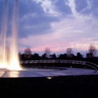
Lake Afton is a man-made pond you’ll find downtown at Main Street and Afton Avenue. The small lake was first noted in a deed dated 1713. It was created to provide water to run the grist mill, and these days, it’s a popular spot for ducks, fishermen and ice skaters.
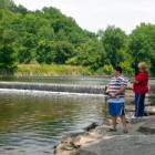
You’ll also find the Yardley Grist Mill, which has been a center of commerce since its inception in the late 1600s. During the Civil War the mill supplied thousands of tons of sorghum and meal to Union soldiers. By 1926 the mill had ceased operation, and has since been restored and now houses several businesses.
Until the mid-20th century, the surrounding countryside was relatively open farmland. While the past two decades have seen much of the agricultural landscape give way to residential development (this area is a bedroom community for Philadelphia, Princeton, and New York), much of Yardley, per se, has retained its historic integrity. A large part of that is due to the town’s preservationist ethic and the creation of a well-maintained historic district.
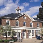
The majority of the buildings within the district are along South Main Street, where you’ll find examples of Second Empire, Queen Anne, and Victorian Gothic architecture. All are enhanced by the presence of trees and shrubs carefully planted to lend the town a residential, neighborhood feel. The historic district encompasses both sections of Canal Street, which runs parallel to the Delaware Canal and is dotted with small, predominantly frame structures dating from 1840. Along the southernmost section of Canal Street is the small-framed Yardley-Bethel A.M.E. Church built in 1877. Several canal bridges and an aqueduct are within the district, as well.
East of the canal along the south side of East Afton Avenue, you’ll find rows of stone homes that mirror the street’s pre-canal days.


