MENU
  • Trail Heads
  • Town
  • Things to Do
  • Information
  • Reset Map

Trail Sections

Trail Status Key

  • Complete, open and improved
  • Obstruction within trail section, see description
  • Planned Future linkage and trail development
  • Unimproved open, travel at your own risk

Towns

Things to Do

Trail Section: Tinicum Park – Virginia Forrest Recreation Area

Status: Obstruction within trail section, see description

Distance: 9.7

TOWPATH CLOSURE (MILE 35 and 35.5) the Towpath at Bridge 3 Ln and Bridge 4 Ln (Smithtown Bridge 3 and Bridge 4) in Tinicum Township will be CLOSED to all pedestrian traffic until further notice due to construction. The purpose of this closure is for PUBLIC SAFETY. Trail users should turn around at the closure and NOT attempt to get by it.

TOWPATH CLOSURE (MILE 31.1). In the area of Lumberville the towpath is CLOSED at the Lumberville Aqueduct Pedestrian Bridge. The purpose of this closure is for PUBLIC SAFETY while the aqueduct and trail are reconstructed. Trail users should turn around at the closure and NOT attempt to get by it.


This section is part of over 50 miles of the D&L Trail designated as National Recreation Trail within Delaware Canal State Park from Easton to Bristol near Philadelphia. For more information specific to the D&L Trail along the Delaware Canal please refer to the Delaware Canal State Park.

________________________


Download a PDF map of this section

Things to Do

1

Delaware Canal State Park

The Delaware Canal is the only remaining continuously intact canal of the great towpath canal building era of the early and mid-19th century. Mule- drawn canal boat rides and the Lock Tender’s House Visitor Center are at New Hope. Paralleling... More

Get Directions
2

Erwin-Stover House & Barn

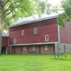
Built by William Erwin, for whom the town of Erwinna is named, it was part of the original 1681 land grant given to William Penn by King Charles II of England. A portion of the house was constructed in 1800... More

Get Directions
3

Nockamixon State Park

A haven for birds of prey and adventurers, Nockamixon State Park also features steep cliffs suitable for rock climbing. The name comes from the American Indian phrase "nocha-miska-ing" which is Lenni Lenape for "at the place of soft soil." Several... More

Get Directions
4

Tohickon Valley Park

Just down stream from Ralph Stover State Park, Tohickon Creek tumbles  over and around many large boulders, forming small pools and falls. The Tohickon’s clean, cool water helps many visitors to end up with at least their feet in the... More

Get Directions

Thank you for visiting the D&L Trail Interactive Map.

Delaware & Lehigh National Heritage Corridor (DLNHC) is a nonprofit organization that convenes over 30 local landowners that build and maintain the trail from Wilkes-Barre to Bristol.

Please Note: if there is an obstruction within a trail section the entire trail section will be noted as “obstructed”. Be sure to read the description of each trail section to learn the extent of the obstruction and how it may impact your trip. The information on this map is updated with information provided by landowners. An update will remain posted until the landowner confirms it is no longer relevant.

When on the trail you are in a public space and natural area, and you may encounter a range of wildlife, plants, and people. There are unhoused individuals along sections of the D&L Trail that travel through heavily populated areas. The perception of safety is different for each trail user – please stay alert and plan accordingly for your personal comfort level. For more information visit our Plan Your Trip page.

×