MENU
  • Trail Heads
  • Town
  • Things to Do
  • Information
  • Reset Map

Trail Sections

Trail Status Key

  • Complete, open and improved
  • Obstruction within trail section, see description
  • Planned Future linkage and trail development
  • Unimproved open, travel at your own risk

Towns

Things to Do

Trail Section: Bethlehem – Freemansburg

Status: Complete, open and improved

Distance: 3.5

UPDATE 6/17/2024: A contractor will be working to remove debris and fallen trees from the canal from 6/17-6/21 from Sand Island (MM 71.2) to the Minsi Trail bridge (MM 69.8). Use caution when navigating this section as access may be limited. 


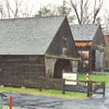
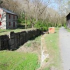
This section of the D&L Trail continues to follow the towpath with views of the historical Bethlehem Steel site across the river and its current transformation. About halfway between Bethlehem and Freemansburg, there is a picnic area and canal lock #43 at Charlie Brown’s Clearing. In Freemansburg, the trail passes the Freemansburg Canal Education Center in the historic mule barn. This is the site of Delaware & Lehigh National Heritage Corridor fall field trips about life as a canal locktender family.

The Bethlehem Sand Island Trailhead and Freemanburg Trailhead are both also near Lehigh River Water Trail access points. Please refer to Wildlands Conservancy’s Lehigh River Water Trail website for more information on trips along the water trail.

Download a PDF map of this section

Things to Do

1 Aardvark Sports Shop - Bethlehem

Aardvark Sports Shop

D&L Trail Friendly Business There is no better place to gear up for all your running needs than Aardvark Sports Shop.  Located a half mile off the D&L Trail in historic downtown Bethlehem, Aardvark has helped local runners since 1984.  From... More

Get Directions
2

Banana Factory

The Banana Factory, a community arts center and gallery, recognizes the importance of the visual arts and has dedicated itself to promoting and sharing them with everyone, regardless of age, race or economic background. From gallery exhibitions by nationally-known artists... More

Get Directions
3

Burnside Plantation

Burnside Plantation is an 18th century Moravian farm that today is a living history museum. The Plantation demonstrates farming methods between 1748 and 1848, a time of great change in agriculture. Learn what life was like on a Moravian farm... More

Get Directions
4

Freemansburg Canal Education Center

The Delaware & Lehigh National Heritage Corridor, the Borough of Freemansburg, and the Bethlehem Area School District partnered to create the Freemansburg Canal Education Center (FCEC) at the Lock 44 canal complex in Freemansburg. The Delaware & Lehigh National Heritage... More

Get Directions
5

Kemerer Museum of Decorative Arts

The Kemerer Museum of Decorative Arts uses period rooms to showcase nearly three-hundred years of folk art, furnishings and paintings. Its unique collection of cast-iron toys, maps, prints, and textiles open a window into the past. Knowledgeable guides take visitors... More

Get Directions
6

Moravian Museum of Bethlehem

In 1752, an apothecary  was built in the center of Moravian Church country, a Protestant denomination. The Moravian Museum of Bethlehem stands on the site of this house of medicine. See a fascinating exhibit including a set of apothecary jars... More

Get Directions
7

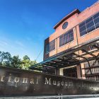
National Museum of Industrial History

A Smithsonian Institution-affiliate, the National Museum of Industrial History is dedicated to forging a connection between America’s industrial past and the innovations of today by educating the public and inspiring the visionaries of tomorrow. Housed in the 100-year-old former Bethlehem... More

Get Directions

Thank you for visiting the D&L Trail Interactive Map.

Delaware & Lehigh National Heritage Corridor (DLNHC) is a nonprofit organization that convenes over 30 local landowners that build and maintain the trail from Wilkes-Barre to Bristol.

Please Note: if there is an obstruction within a trail section the entire trail section will be noted as “obstructed”. Be sure to read the description of each trail section to learn the extent of the obstruction and how it may impact your trip. The information on this map is updated with information provided by landowners. An update will remain posted until the landowner confirms it is no longer relevant.

When on the trail you are in a public space and natural area, and you may encounter a range of wildlife, plants, and people. There are unhoused individuals along sections of the D&L Trail that travel through heavily populated areas. The perception of safety is different for each trail user – please stay alert and plan accordingly for your personal comfort level. For more information visit our Plan Your Trip page.

×